|
Plat Services
|
|
| AIMS offers users several options when searching recorded plats in
Johnson County. Public access is available with limited free downloads, while a
subscription-based access is offered to users with a higher volume need.
Utilizing the subscription service enables users to access the functionality of
the Map Search
where they can interact with the map to find the desired plat image.
|
| Public Plat Search Access - Go |
|
Subscription Plat Search Access |
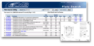
Free Database Search
Users can search the AIMS data base for plats by plat name, book/page, AIMS map
number, year platted, date recorded, city and plat id. Users are provided with
options to view a thumbnail of the scanned image, view the location of the plat
in the AIMS Online Mapping System and download one free scanned plat image (in
TIF format) per user (based on IP address) every 7 days. Additional scanned
images can be downloaded for $5 each.
|
|
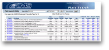 Database Search Go
For high volume users, AIMS offers an annual subscription service for searching
plats. Users gain access to the same functionality of the public access service,
along with unlimited image downloads and access to the Map Search application
detailed below. The annual subscription is available for $180 per user.
|
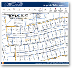 Map Search Go
Available to Plat Search Subscribers, this application allows an interactive,
map-centric search of the plat database. Users can search the map by address,
parcel id, plat name, plat subcode, and Township-Range-Section. The scanned plat
images are geo-referenced and can be viewed with the current property lines and
plat outlines overlayed. The option to download the TIF image is provided, along with
standard mapping tools such as pan, zoom in/out, measure, and property searches.
|