AIMS offers a variety of mapping services in addition to the publicly accessible
Johnson County Online Mapping application which you can access by clicking on the Online Mapping button above. Other mapping services which AIMS provide vary in their use from economic development, to utility data management, to crime mapping, among other things. Please see
the list of mapping services below for a brief description. If you would like to learn more about any of the following services, or if you have an idea for a service that you would like to see implemented please contact us so that we may further assist you.
Address Web Service
The Address Web Service is an application developers tool. With the address web service you can validate an address or a full database of addresses against the county standard for addressing.
If an address is validated by the Address Web Service the X, and Y coordinates of
the location will be returned along with other information pertaining to the address. Having the X and Y coordinates
allows a developer to do on the fly geocoding with the Address Web Service.
To see a full description of the address web service please click
here.
CERI
AIMS and the Center for Economic Research Institute (CERI) partnered to create a
web application that uses GIS to aid in the creation of trade area profiles.
Trade area profiles are typically requested by developers and commercial real estate
agencies when they need to analyze consumer demographics when locating new businesses.
The CERI web mapping application allows users to interactively select an area
for analysis, then it calculates the number of commercial and residential units and the average appraised value for a single family home.
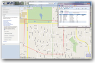
Collaborative Utility Exchange (CUE)
The CUE is a coordination effort between the utility
community of Johnson County & AIMS to produce a comprehensive data store and
portal for warehousing and viewing underground utility infrastructure. CUEView is a
secure internet application that provides a window into a repository of information
which includes land records, photography, plats, easements and most importantly
a collection of utility infrastructure data provided by participating utilities
within the County. Click
here for more information about CUEView.
Johnson County Land Records (JCLR)
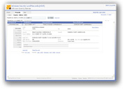
The Johnson County Land Records (JCLR) application
is a centralized portal for researching land record information in Johnson County
. It is an internet based application which allows access to three primary types
of information, land attribute data, spatial data, and scanned documents.
Inside JCLR users have the ability to create protest petition reports, view parcel
spatial history, create buffer maps, and a variety of other things. JCLR is
a secured internet application which is accessible through the myAIMS application
portal. More information is available by clicking
here.
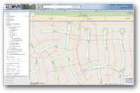
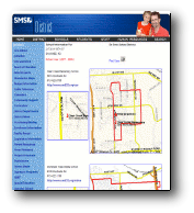
Crime Mapping
This application is an internet based crime mapping solution
created
for local police departments which provides access for both the public and
Leawood's internal staff to
query and view crime data on maps.
What is unique about this application is that it strays from the reliance on expensive
and cumbersome internet mapping packages and uses a freely available, open source
internet mapping platform from Google. Each entity can then add a
customized background, or "wrapper", to the application and integrate directly
into an existing website.
Click the links below to view these applications
School Locator Web Service
The School Locator Web Service is an application developers tool, which allows a
developer to integrate AIMS mapping and school location services into their application
for the purposes of determining which school a supplied address should be attending.
By supplying an application integrated with the School Locator Web Service a valid
Johnson County address the web service returns the appropriate elementary, middle,
and high school boundary maps along with contact information for the given schools.
The School Locator Web service is being used by a majority of the school districts
within Johnson County to view the applications yourself please click the following
links: